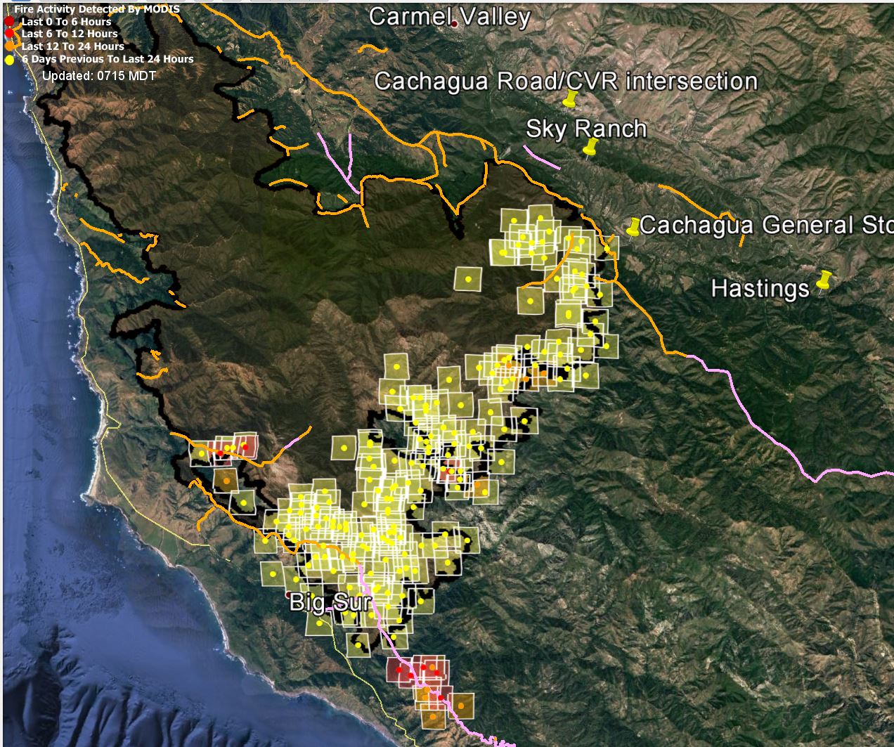
I’ve got freash MODIS and VIIRS data this afternoon. I’ll show you the MODIS data first, but, if you’re in a hurry, I suggest you skip it and go right to the VIIRS data below it.
I’ll give you my comments referencing the VIIRS maps.

Pretty impressive show of heat in the south, huh? Let’s take a closer look, and I’ll mark with red arrows the area where I think there’s a back burn — a huge one, by the looks of it — in progress.
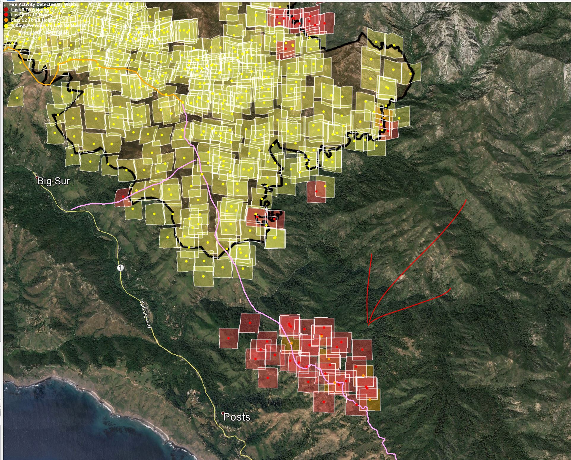
A little north of the image above:

Over near Cachagua:

The orange lines are the dozer fire breaks that were in as of 7/30, plus one that I added by hand. The pink lines are the ones that were planned as of that date. The fat black lines are the outlines of the fire’s perimeter on the official Cal Fire maps from last night.
How to read the MODIS/VIIRS heat indications: The size of the square represents the nominal margin of error. The fire could be anywhere in the square, not just at the center. Dark red squares were detected less than six hours before the data set was created. Light red squares were detected less than twelve hours before the data set was created. Orange squares were detected less than 24 hours before the data set was created. Yellow squares were detected less than six days before the data set was created. When the squares overlay other objects, the color of the square changes somewhat, but the color of the dot in the middle does not. So look at the dot if you’re uncertain what color the square should be. Since the fire is now over six days old, some of the early detections have dropped off the map. MODIS makes mistakes, sometimes missing outbreaks, and sometime misplacing them outside the nominal margin of error. It is also a snapshot of the activity at the time the satellite is overhead, and will definitely miss flare ups between passes. MODIS can’t tell the difference between wildfires and intentional back burns.
Leave a Reply