If last night's satellite images made it look as if this fire was going away, toady's first-pass MODIS and VIIRS ones make it clear that this thing is not nearly over. First, the VIIRS data. It's much higher resolution than the MODIS data, but we only get two passes a day … [Read more...]
Soberanes Fire aerial/VIIRS/MODIS data — 0600 8/8
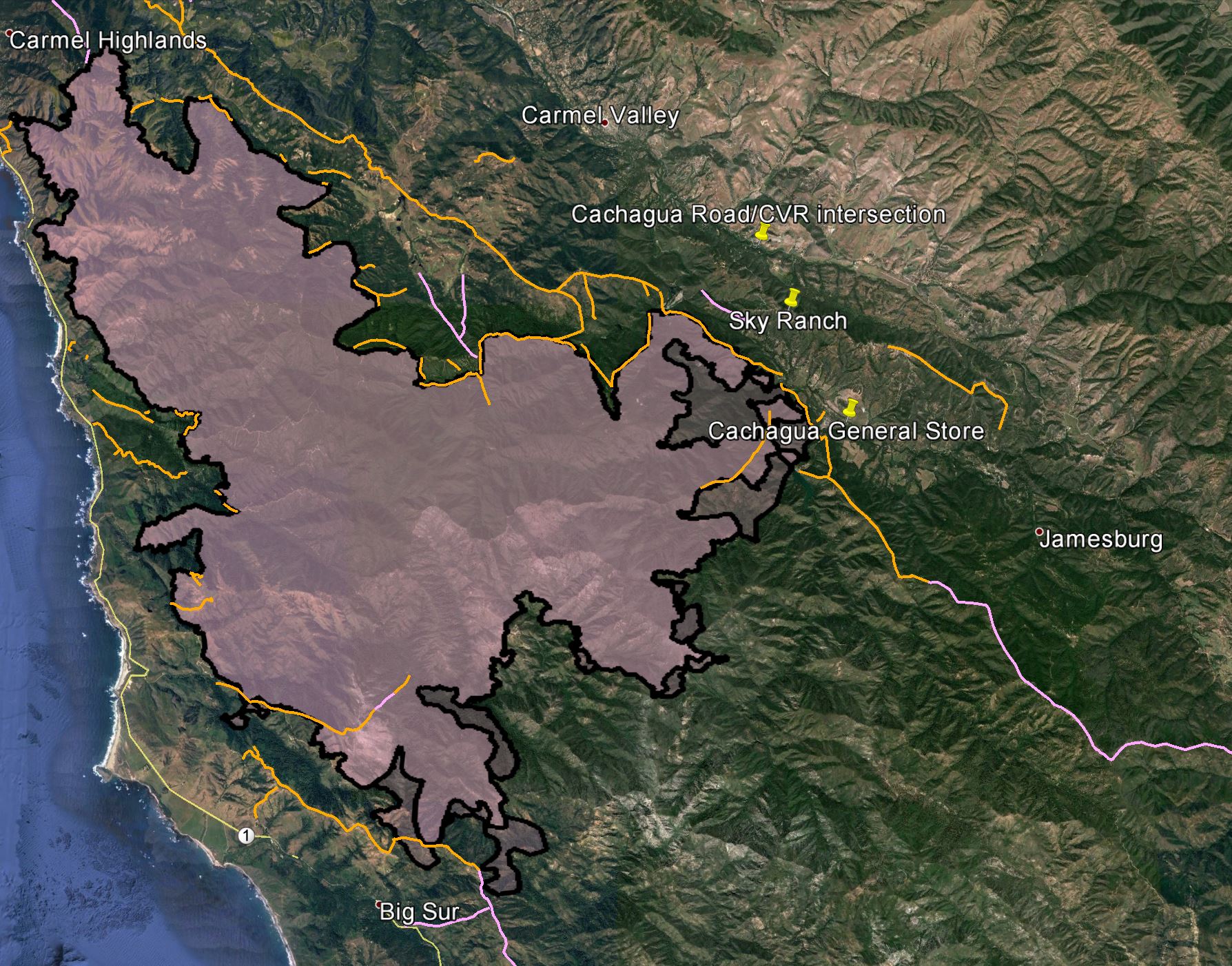
[0900: VIIRS data added below.] The news is unequivocally good. First, the Cal Fire fire perimeter data for last night and the night before, overlaid on each other. Zooming in on the west, where things looked pretty exciting -- and not in a good way -- yesterday … [Read more...]
Soberanes Fire MODIS/VIIRS data — 2100 8/7
I just got back from the SF Bay area and I'm exhausted, but I will post today's VIIRS and MODIS data without comment. VIIRS: West: East: MODIS: West: East: … [Read more...]
Soberanes Fire aerial/MODIS/VIIRS data — 0600 8/7
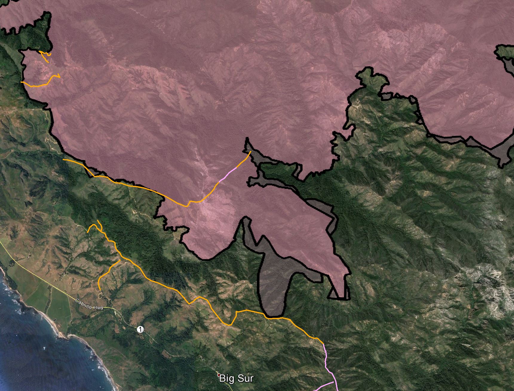
Last night's official fire outline compared to the night before: We see significant expansion in the west towards the village of Big Sur Last night aerial infrared map, with legend in upper left corner: Looking at the western part of the fire. … [Read more...]
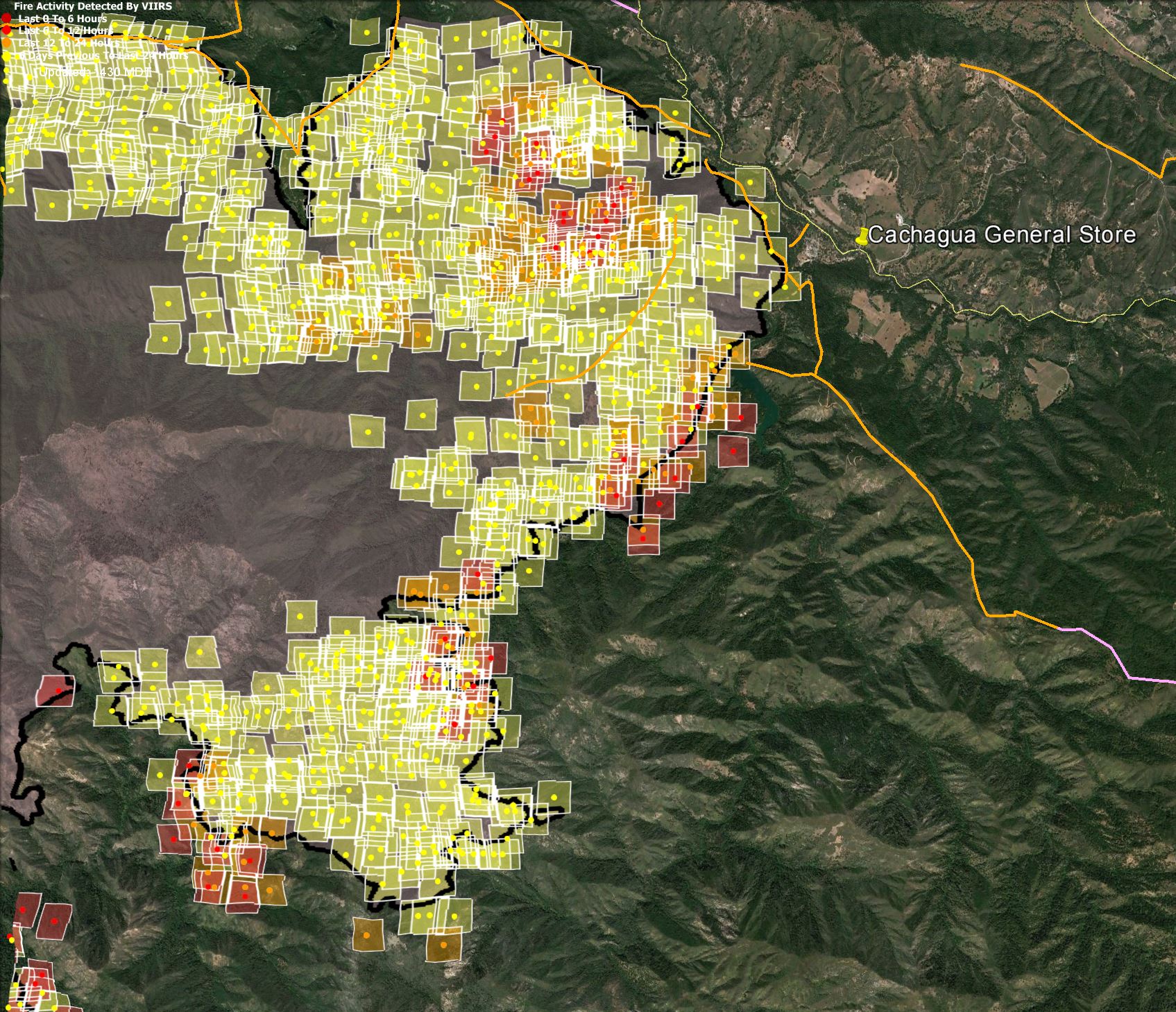
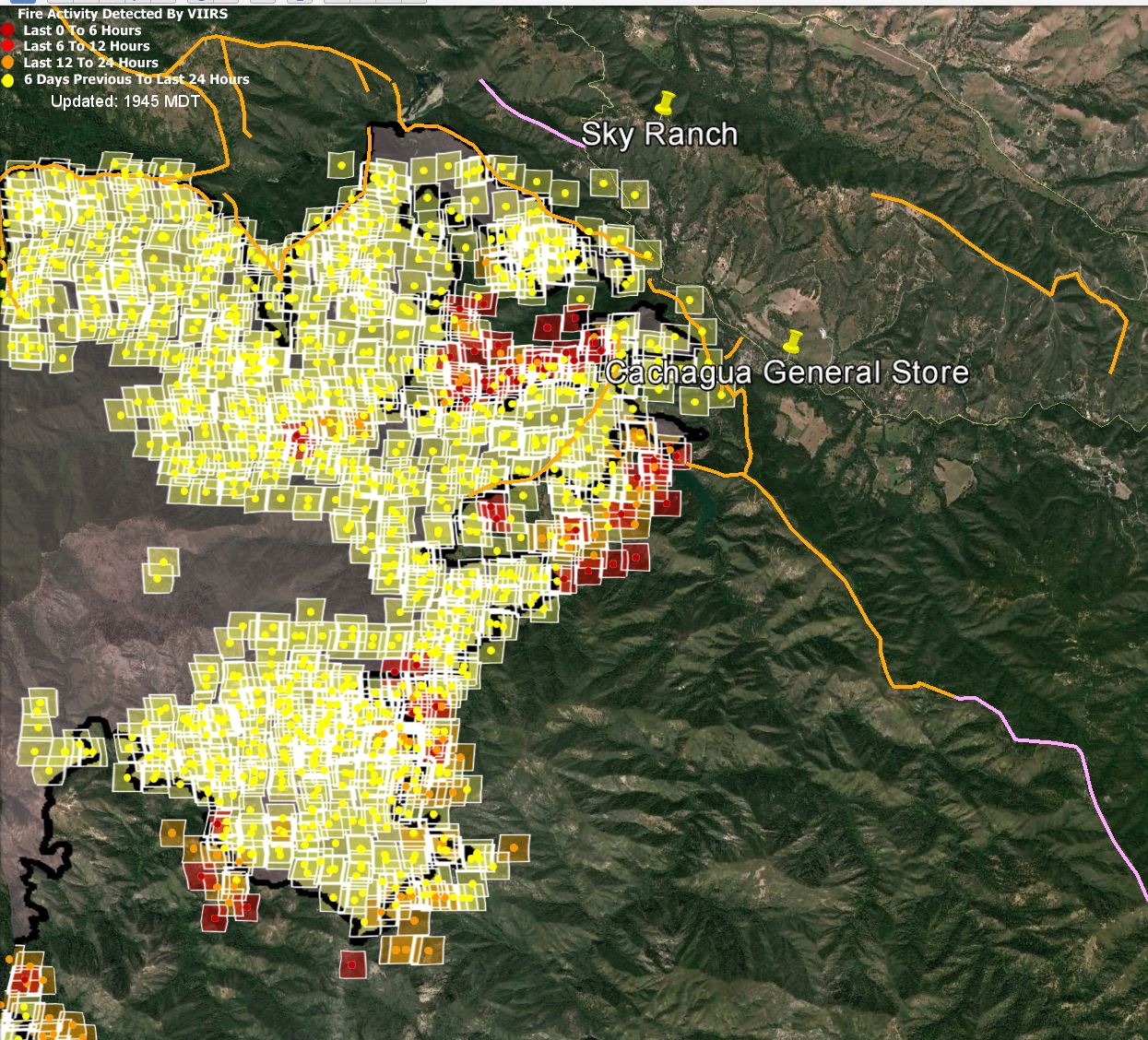
Soberanes Fire MODIS/VIIRS data — 1400 8/6
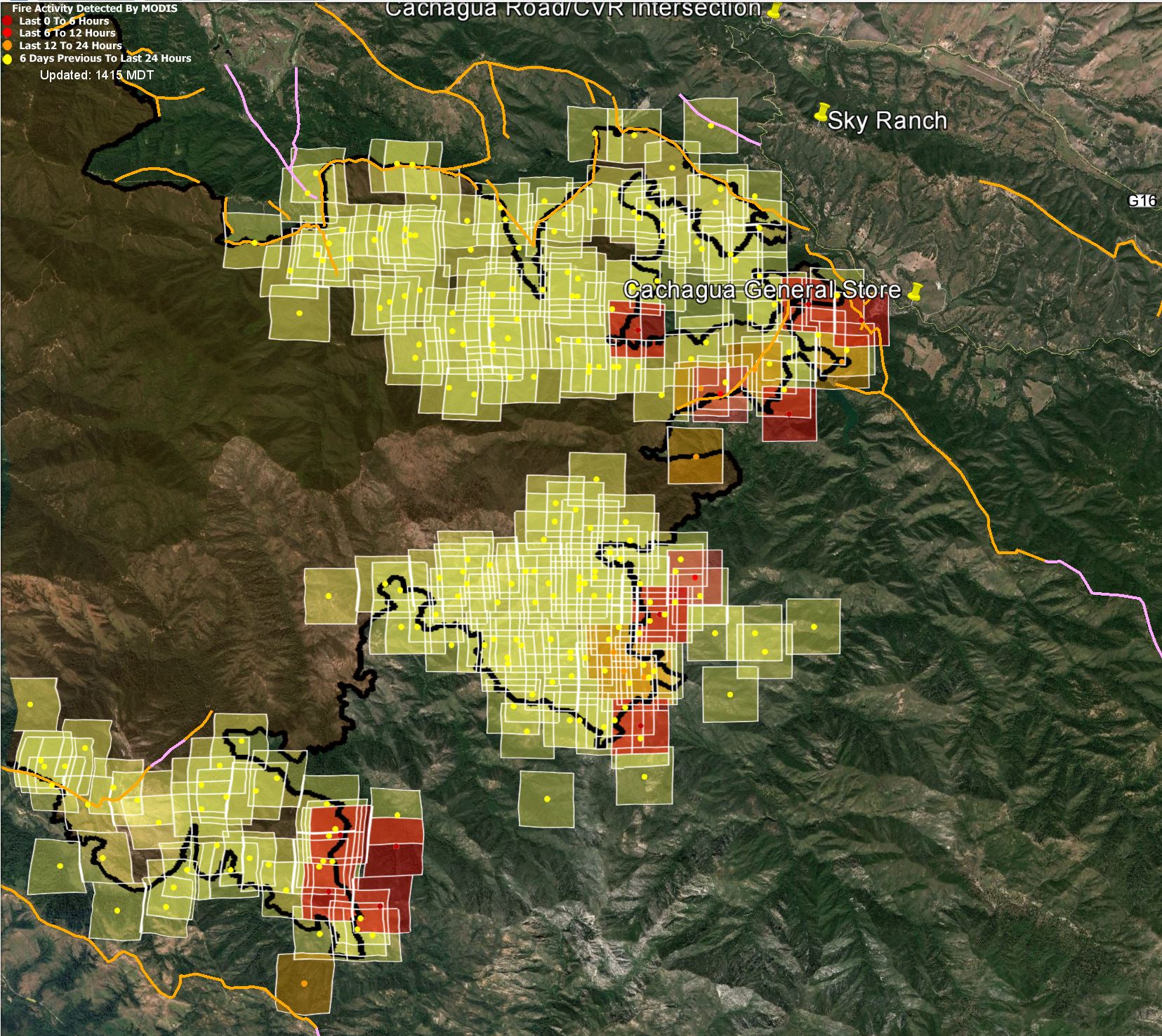
We now have new MODIS data: It looks a lot like the VIIRS data from the previous post, except lower resolution. Zooming in: The same areas that were worrisome before are still that way. I hope the hotspots near the General Store are back burns. [Added … [Read more...]
- « Previous Page
- 1
- …
- 24
- 25
- 26
- 27
- 28
- …
- 66
- Next Page »