I interrupt this string of posts about the Soberanes Fire for one on this blog's main subject (before I hijacked it for fire posts), my struggles with technology. Today's topic is not a new one: Adobe Creative Cloud licensing issues. Here's the story: I took a computer … [Read more...]
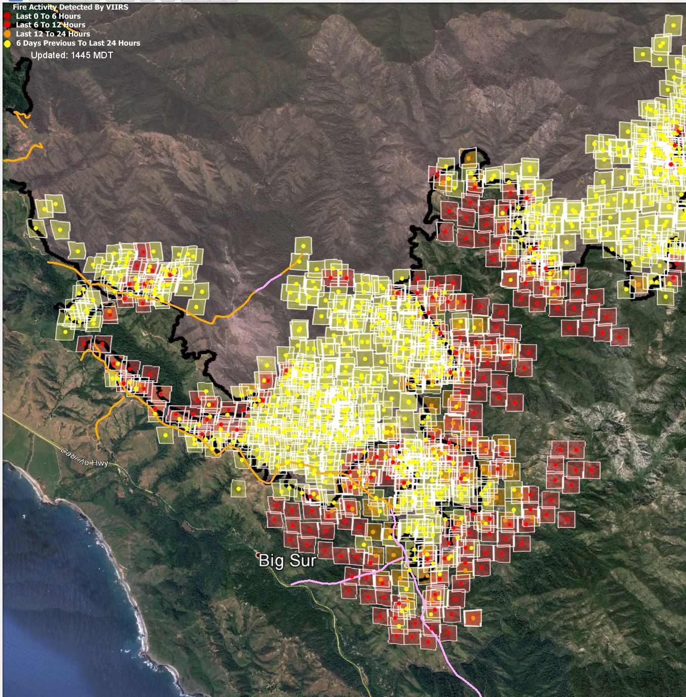
Soberanes Fire VIIRS data — 0700 8/10

I'm not able to get the aerial infrared data sets this morning, and MODIS is still being balky [Added 0930. I was wrong. MODIS was working fine, but it didn't find any fire overnight, which fooled me. I'll post the map below.], but I have the new offical fire outline and the … [Read more...]
Soberanes Fire MODIS/VIIRS data — 2100 8/9

The second VIIRS pass and the MODIS data looks better for the area around the villliage of BIg Sur. First, VIIRS: In the west: Nothing new near the inhabited area around Big Sur. The western part of the fir continues towards the east. In the east: The … [Read more...]
Soberanes Fire VIIRS data — 1400 8/9
It looks like the first MODIS pass today missed us, and the second one is just about to happen, but I have VIIRS data for today's daylight pass. It doesn't look pretty: In the west: The heat on the good side of the northwestern portion of the fire break looks like … [Read more...]
Soberanes Fire aerial/VIIRS/MODIS data — 0730 8/9
It took me a while to get the MODIS and VIIRS data sets to download, but I finally have all three IR maps and the official fire perimeter. First, last night's and the nigh before's fire perimeter overlaid on the same Google Earth map: In the west, we see the long skinny … [Read more...]
- « Previous Page
- 1
- …
- 23
- 24
- 25
- 26
- 27
- …
- 66
- Next Page »