We have the results of the second midday MODIS satellite pass, and it's modest good news for Cachagua residents: the new hot spots aren't headed right for us. The fire breaks that were complete as of midnight 7/30 are in orange. The proposed ones are in pink. I still don't … [Read more...]
Soberanes Fire MODIS data — 1330 7/31
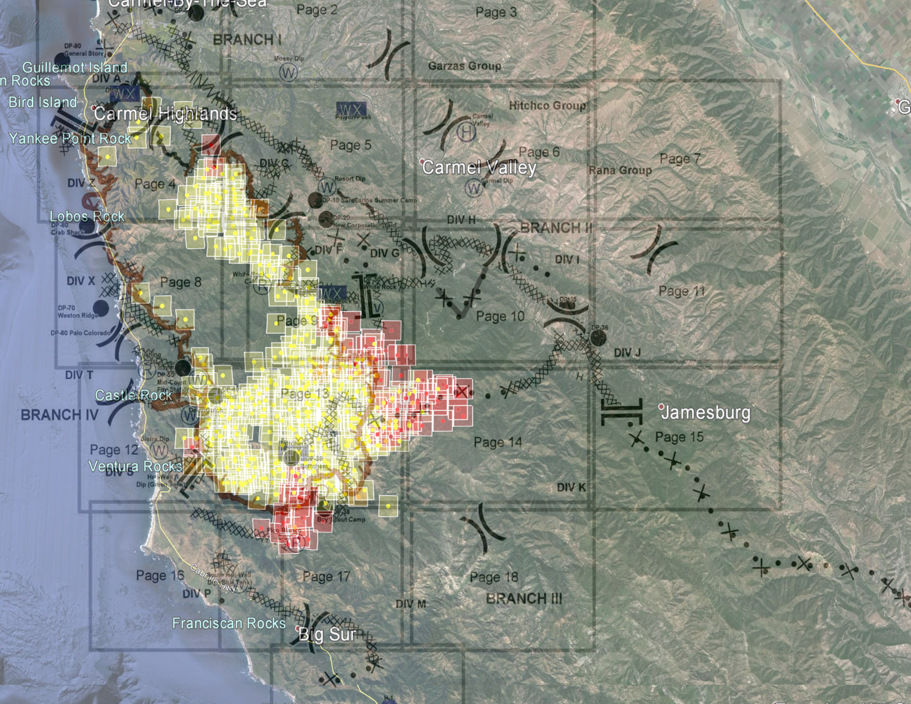
I've been searching for better ways to present the MODIS data, and in this post I'll try a new one. I downloaded the fire outline as of midnight last night into Google Earth. I changed the color and put a heavy black border around it: Then I downloaded the MODIS aged hot … [Read more...]
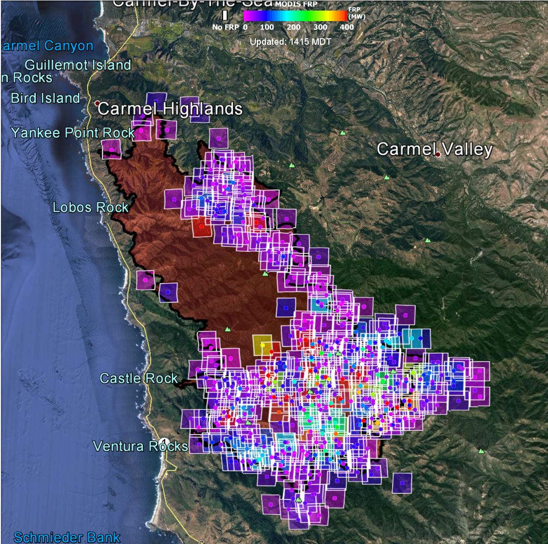
Soberanes Fire MODIS data — 0800 7/31
The fire made significant progress towards the south and east overnight. I will present only one image this morning, which I think sums up the situation pretty well. This image has the MODIS data set as of this morning brought into Google Earth. Overlaid on that is the … [Read more...]
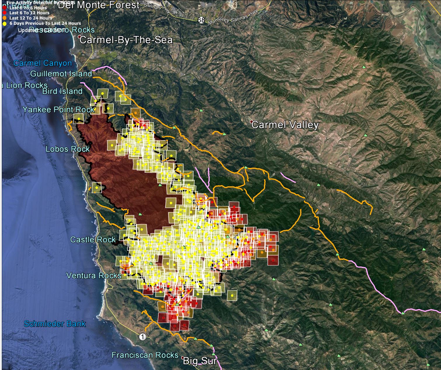
Soberanes Fire MODIS data — 2100 7/30
Virtually no enlargement of the fire perimeter today up to the noonish satellite passes, according to MODIS. The visible band MODIS image from this afternoon at about one showed smoke drifting across much of northern California: In the UV/IR false-color MODIS … [Read more...]
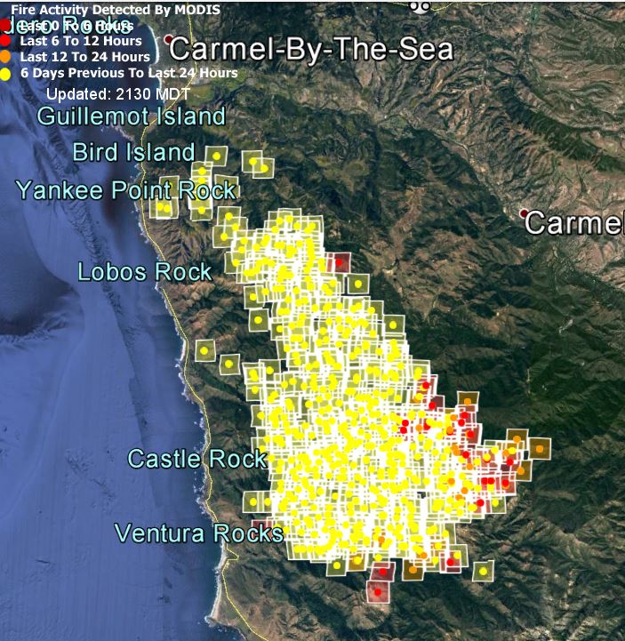
Soberanes Fire MODIS data — 0600 7/30

The southern part of the fire progressed eastward overnight, but there was no heat detected in the formerly threatened parts of Carmel Highlands and Rancho San Carlos. There is a hot spot near White Rock, which may be a back burn. It is now a little over three miles from … [Read more...]
- « Previous Page
- 1
- …
- 26
- 27
- 28
- 29
- 30
- …
- 64
- Next Page »