
I've got freash MODIS and VIIRS data this afternoon. I'll show you the MODIS data first, but, if you're in a hurry, I suggest you skip it and go right to the VIIRS data below it. I'll give you my comments referencing the VIIRS maps. Pretty impressive show of heat in … [Read more...]
Soberanes Fire aerial/MODIS/VIIRS data — 0630 8/12

Today, after a two day gap, we have aerial infrared data. And we have not seen such low activity in a long time. In the west: In the east: There are hardly any areas labeled has intense, However, there's a caveat. Because of the cloud cover, the plane was … [Read more...]
Soberanes Fire MODIS/VIIRS data — 0630 8/11

Note: more VIIRS and MODIS data has been added below. No aerial IR data again today. Here's last night's official Cal Fire outline, overlaid on the night before's: In the west, the expansion is mostly away from structures: In the east, the gradual push to the … [Read more...]
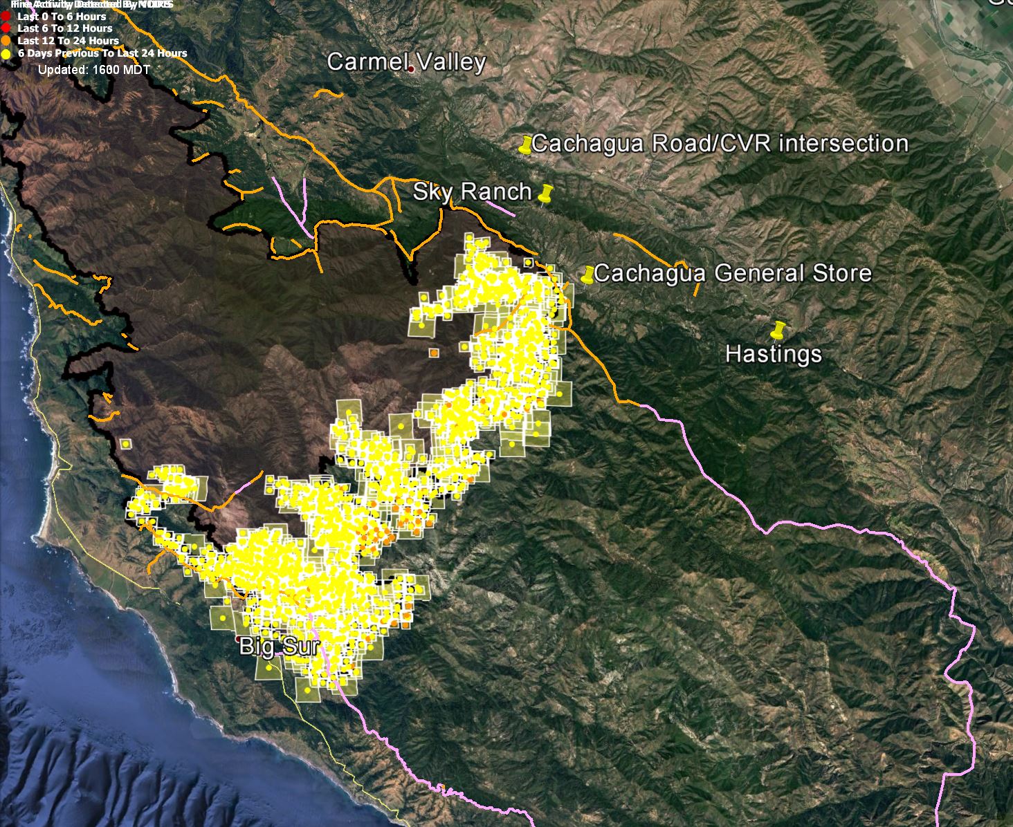
Soberanes Fire MODIS/VIIRS data — 1600 8/10
There was a MODIS pass at 1:40 PDT. If the server is working right, it didn't find any fire. There is another MODIS pass later the afternoon, and a VIIRS pass as well. I'll add those to this post as I get the data. I don't think we're going to get aerial IR data from last night. … [Read more...]
Adobe CC licensing, yet again
I interrupt this string of posts about the Soberanes Fire for one on this blog's main subject (before I hijacked it for fire posts), my struggles with technology. Today's topic is not a new one: Adobe Creative Cloud licensing issues. Here's the story: I took a computer … [Read more...]
- « Previous Page
- 1
- …
- 22
- 23
- 24
- 25
- 26
- …
- 66
- Next Page »